-
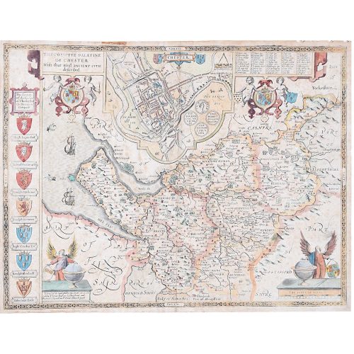
John Speed/Speede (1551/2-1629) The Countye Palatine of Chester with that most ancient citie
39x51cm Engraving Probably the most famous early English mapmaker, John Speed's early life is somewhat of an enigma. He is believed to have trained as a rolling-press printer, but he was at heart an historian granted a sinecure in the Customs House by Queen Elizabeth to indulge his passion, later becoming a Fellow of the Society of Antiquaries. His first maps were historical, of the Holy Land 'Canaan as it was Possessed both in Abraham and Israels Dayes' and of England and Ireland recording 'all their Civill Warres since the Conquest'. In 1611 he published his 'Hostory of Great Britaine' which he regarded as his magnum opus, but it was the companion atlas 'Theatre of the Empire of Great Britaine' that - as the first printed atlas of Great Britain - sealed his reputation. William Rogers engraved the first map, 'the County Palatine of Chester' in about 1600, but following his untimely death the task of engraving was passed to Jodocus Hondius of Amsterdam. By 1612 the atlas was complete, the maps famed for their decorative elements. Many have town plans - Brtiain's first series of such plans - and descriptive text was printed to the reverse until the 1676 edition. Later printings (up until 1770) were issued without this text. By 1627 it has become a part of a world atlas 'Prospect of the Most Famous Parts of the World'. During the 17th century the plates passed through the hands of a series of publishers, the 1676 edition (as here) of Thomas Bassett and Richard Chiswell being regarded as its high point with the inclusion for the first time of a series of important maps. If you are interested email info@manningfineart.co.uk or call us on 07929 749056. Condition: Trimmed and other small losses outside platemark. Some toning and spotting to paper as usual. Later but well undertaken hand-colouring. Old tape mark to top outside platemark. Generally good condition. -
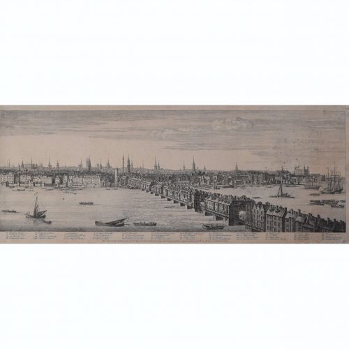
Samuel Buck (1696-1779) & Nathaniel Buck (active 1724-59) Panorama of the River Thames from Westminster Bridge to London Bridge
Published September 1749 30x404 cm Engraving Scroll down for further description. If you are interested email info@manningfineart.co.uk or call us on 07929 749056. -
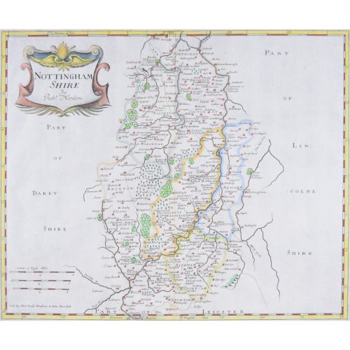
Robert Morden (1650-1703) Nottingham Shire (or Nottinghamshire)
Engraving with recent hand colouring 34x42cm First published in 1695 for Camden's Britannica (1695-1772) and reprinted several times during the succeeding century. -
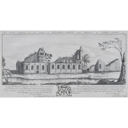
Samuel & Nathaniel Buck
Byland Abbey, Yorkshire
Engraving 37x19cm, c. 1770 "Byland Abbey is an interesting ruin about five miles from Helmsley. It was a fine specimen of ecclesiastical architecture, founded by the monks of Furness, who were driven from their establishment in Lancashire during an incursion of the Scots. When the abbey was dissolved in 1540 its revenues amounted to 238l. 9s. 4d." (Source: The Penny Magazine of the Society for the Diffusion of Useful Knowledge 25 June 1836.) -
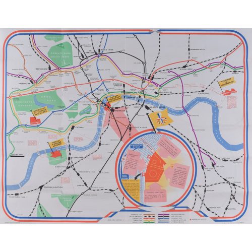
James Hart
Festival of Britain
Lithographic poster map 45 x 58 cm Folding map published for London Transport and British Railways for visitors to the 1951 Festival of Britain, featuring the Abram Games logo, details of water bus services, a detailed plan of the Lambeth exhibition area by Waterloo Bridge. If you are interested email info@manningfineart.co.uk or call us on 07929 749056. -
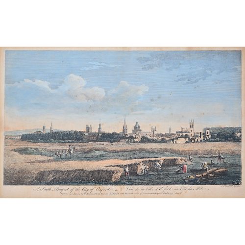
John Boydell (1719-1804)
A South Prospect of the City of Oxford
Hand-coloured engraving published 1751 in the series Four Views of Oxford 28x44.5cm If you are interested email info@manningfineart.co.uk or call us on 07929 749056. One of the most influential Georgian printsellers, Boydell was apprenticed to William Henry Toms at the age of 21, studying drawing at the St Marin's Lane Academy. From 1755 he imported foreign prints in great numbers. He became Mayor of London in 1790. -
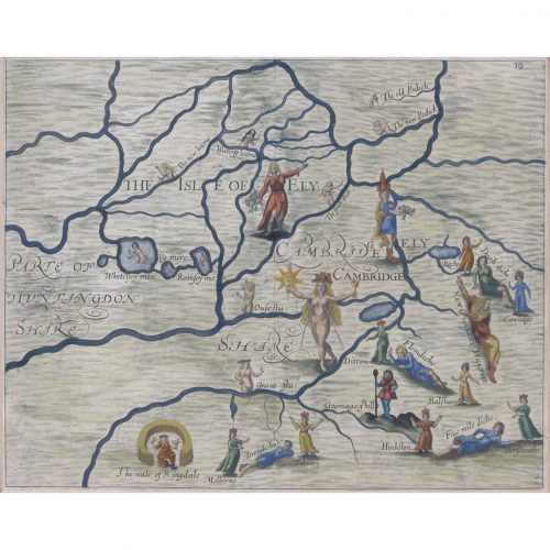
Map of Cambridge and the Isle of Ely (1622) engraved by William Hole for Drayton’s Poly Olbion
London (1622) 24 x 31 cm (9 x 12 in) If you are interested email info@manningfineart.co.uk or call us on 07929 749056. -
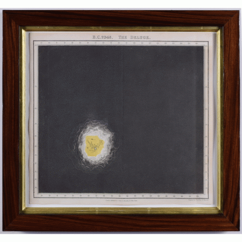
Edward Quin (British 1794-1828)
Twenty-one maps from An Historical Atlas in a Series of Maps of the World As Known at Different Periods.
Twenty-one hand-coloured engraved maps, various sizes, presented in fine hand-finished rosewood veneer frames. Click on the image to see all twenty-one maps. 15 approx 40 x 31 cm 5 approx 62 x 31 cm Seeley and Burnside np. nd. [London c. 1830] Scroll down for further information. -

Macdonald (Max) Gill (1884-1947)
Australia: Her Natural and Industrial Resources (1950)
His Majesty’s Stationary Office, SO Code NO. 70-538-5-2 Lithographic poster 51 x 76cm (20 x 30 inches) Click here for biographical details and other works by the artist. Condition generally very good, a little spotting and the odd very short edge tear to margin not affecting image. If you are interested email info@manningfineart.co.uk or call us on 07929 749056. -
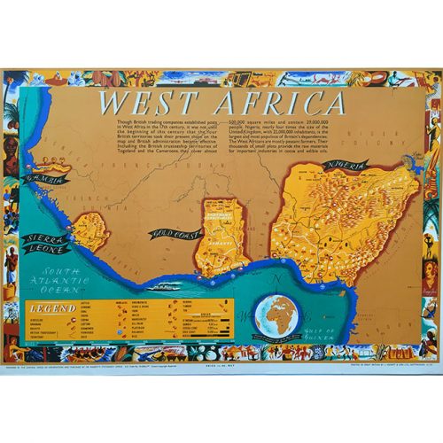
Leo Vernon
West Africa (British Empire 1948)
Printed by J.Howitt & Son Ltd Lithographic poster 20×30 inches If you are interested email info@manningfineart.co.ukor call us on 07929 749056