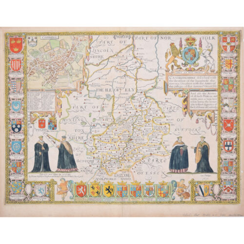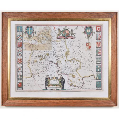


John Speed/Speede (1551/2-1629)
The County of Surrey Described and Divided into Hundreds
Engraving with later hand colouring and text to the reverse
Dated to 1650
36 x 49 cm
Probably the most famous early English mapmaker, John Speed’s early life is somewhat of an enigma. He is believed to have trained as a rolling-press printer, but he was at heart an historian granted a sinecure in the Customs House by Queen Elizabeth to indulge his passion, later becoming a Fellow of the Society of Antiquaries. His first maps were historical, of the Holy Land ‘Canaan as it was Possessed both in Abraham and Israels Dayes’ and of England and Ireland recording ‘all their Civill Warres since the Conquest’.
In 1611 he published his ‘Hostory of Great Britaine’ which he regarded as his magnum opus, but it was the companion atlas ‘Theatre of the Empire of Great Britaine’ that – as the first printed atlas of Great Britain – sealed his reputation. William Rogers engraved the first map, ‘the County Palatine of Chester’ in about 1600, but following his untimely death the task of engraving was passed to Jodocus Hondius of Amsterdam.
By 1612 the atlas was complete, the maps famed for their decorative elements. Many have town plans – Britain’s first series of such plans – and descriptive text was printed to the reverse until the 1676 edition. Later printings (up until 1770) were issued without this text. By 1627 it has become a part of a world atlas ‘Prospect of the Most Famous Parts of the World’. During the 17th century the plates passed through the hands of a series of publishers, the 1676 edition of Thomas Bassett and Richard Chiswell being regarded as its high point with the inclusion for the first time of a series of important maps. For the first half of the eighteenth century they were firmly established in the hands of the Overton family.
This particular edition originally featured in The Theatre Of The Empire Of Great Britaine. It features attractive inset views of the long-since destroyed Richmond and Nonsuch Palaces, compass rose, scale of miles, coats of arms and decorative strapwork. Its hand colouring also lends a bright charm to this map, highlight the fields and adding vibrancy to the coats of arms.
If you are interested email info@manningfineart.co.uk or call us on 07929 749056.
Condition: Generally very good, glued to mount (sold with frame), few creases