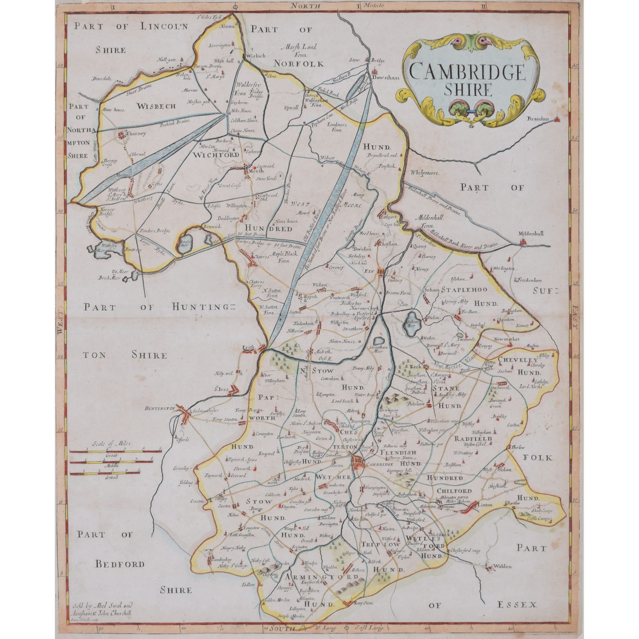
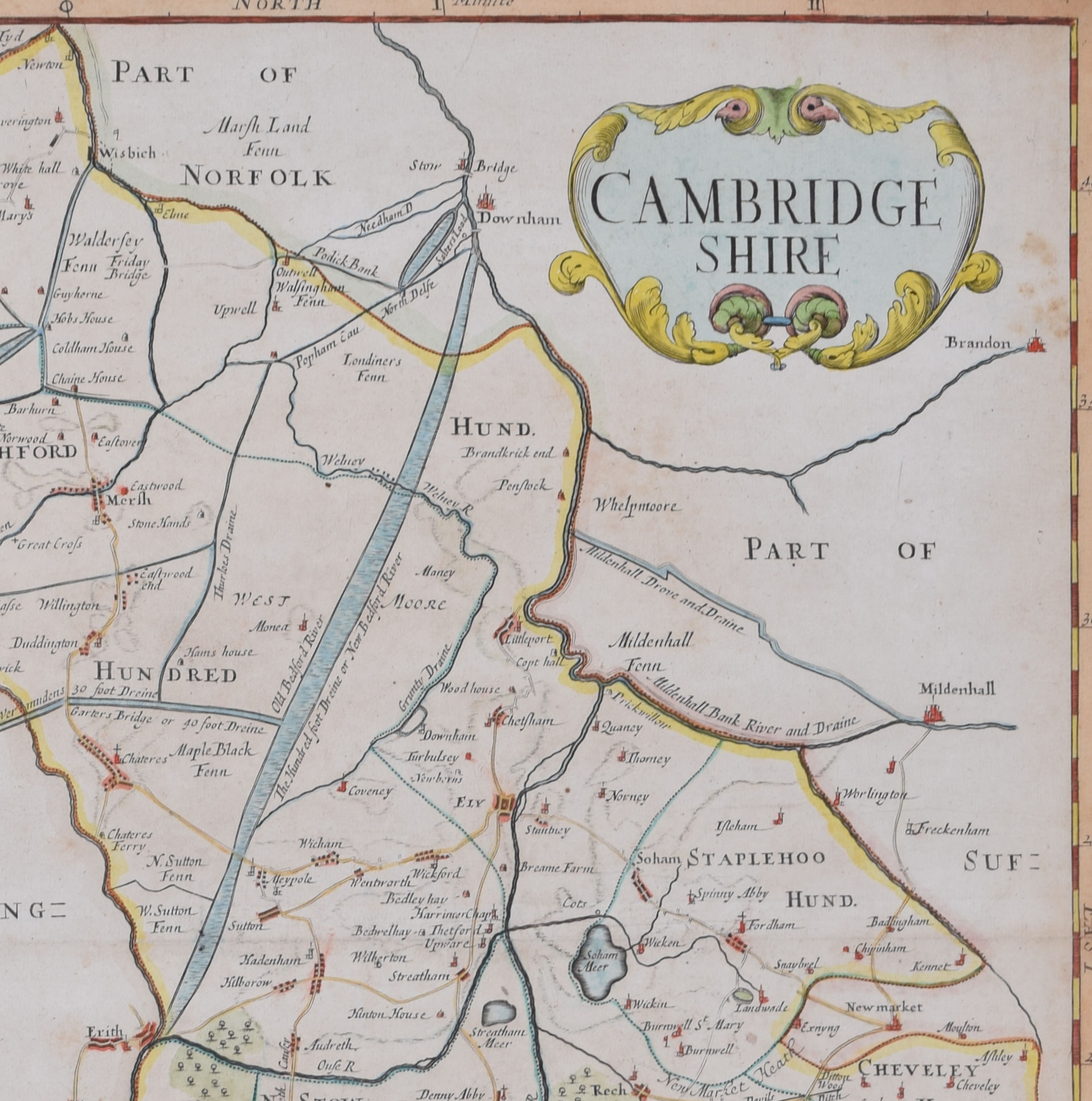
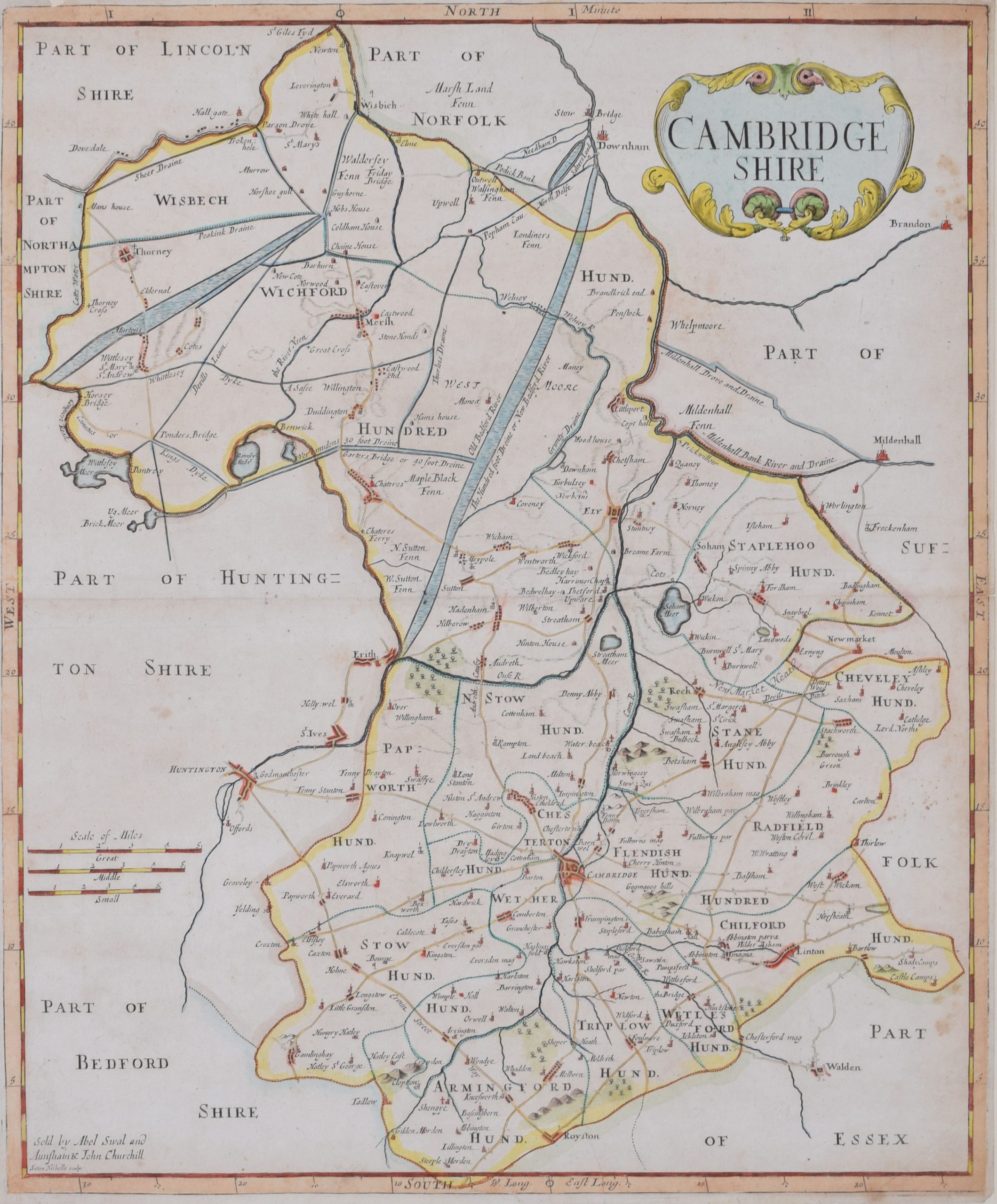
Sutton Nichols (1668 – 1729)
Map of Cambridgeshire
Engraving
43 x 36 cm
Signed in plate lower left.
A beautifully coloured 18th century map engraving of Cambridgeshire. The map was produced by Robert Morden for publication in Edward Gibson’s 1695 translation of William Camden’s Britannia, a topographical and historical survey of Great Britain and Ireland produced to “restore antiquity to Britaine, and Britain to his antiquity” – a most noble aim.
William Camden (1551 – 1623) was an English antiquarian, historian, topographer, and herald, best known as the author of Britannia, the first chorographical survey of the islands of Great Britain and Ireland, and the Annales, the first detailed historical account of the Queen Elizabeth I’s reign.
Sutton Nicholls was a draughtsman and engraver best known for his panoramic views of the cities of London and Westminster. Almost all of his engravings were commissioned by publishers. Nicholls specialised in topographical and architectural designs; he also produced many maps, notably illustrating John Strype’s edition of John Stowe’s ‘Survey of London’ in 1720.
Condition: good. Mounted to board.
If you’d like to know more, please email info@manningfineart.co.uk or call us on 07929 749056.