
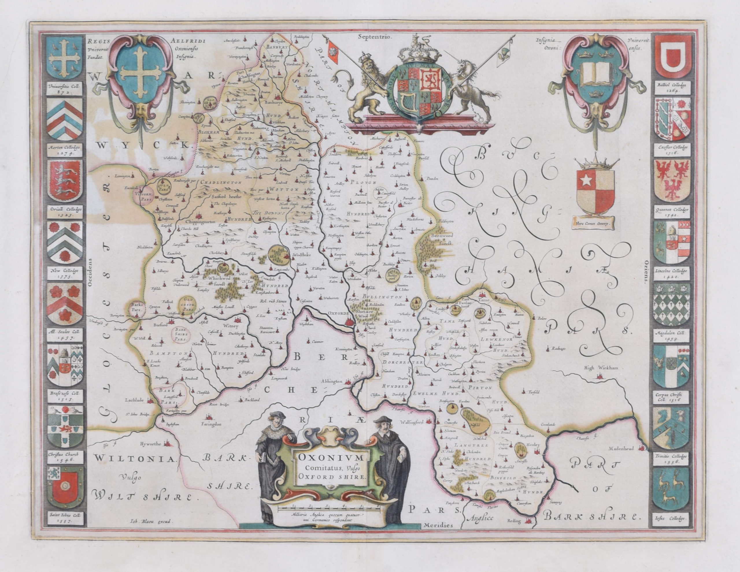
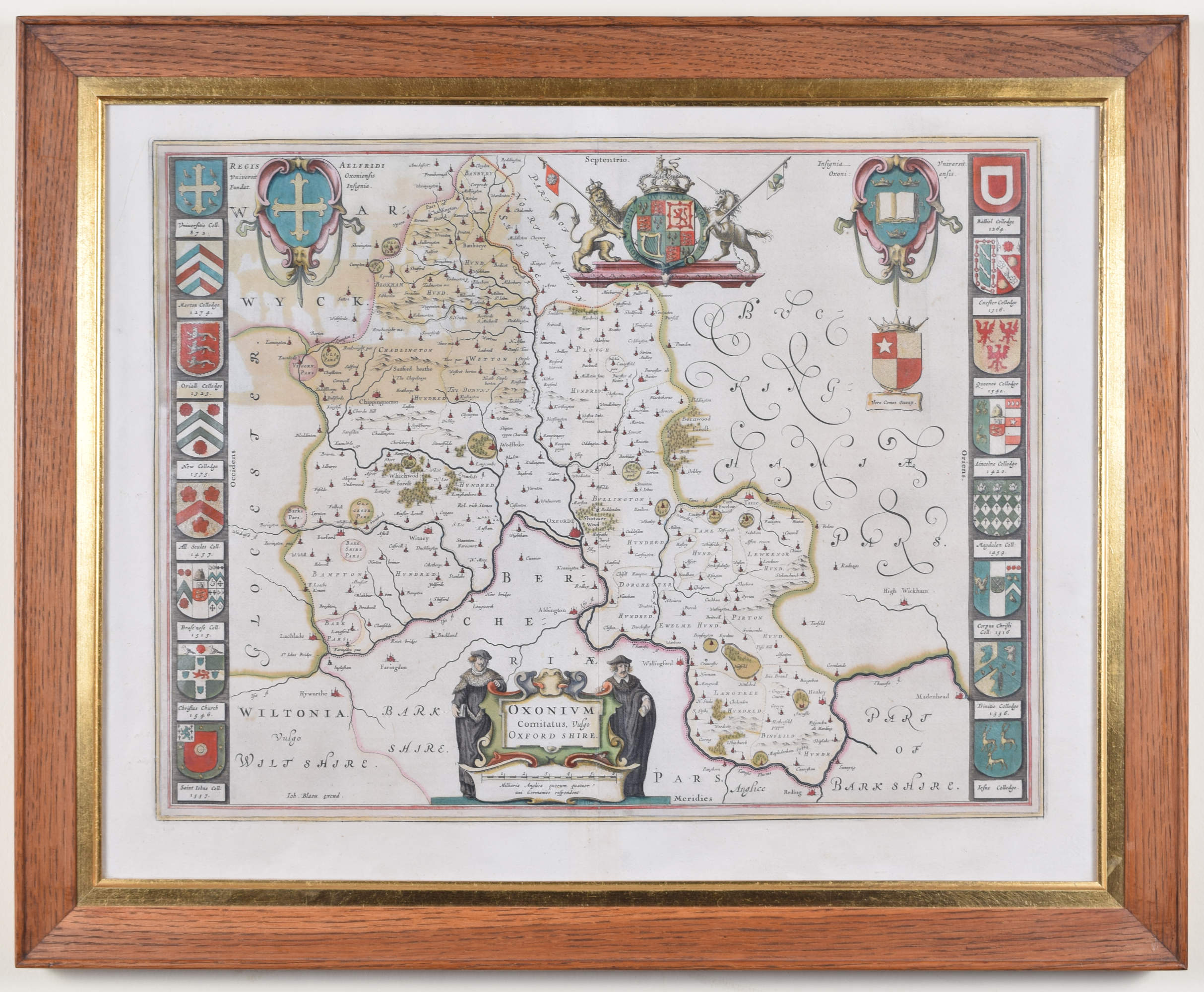
Johannes ‘Joan’ Blaeu (1596 – 1673)
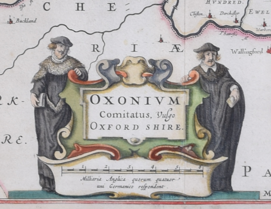
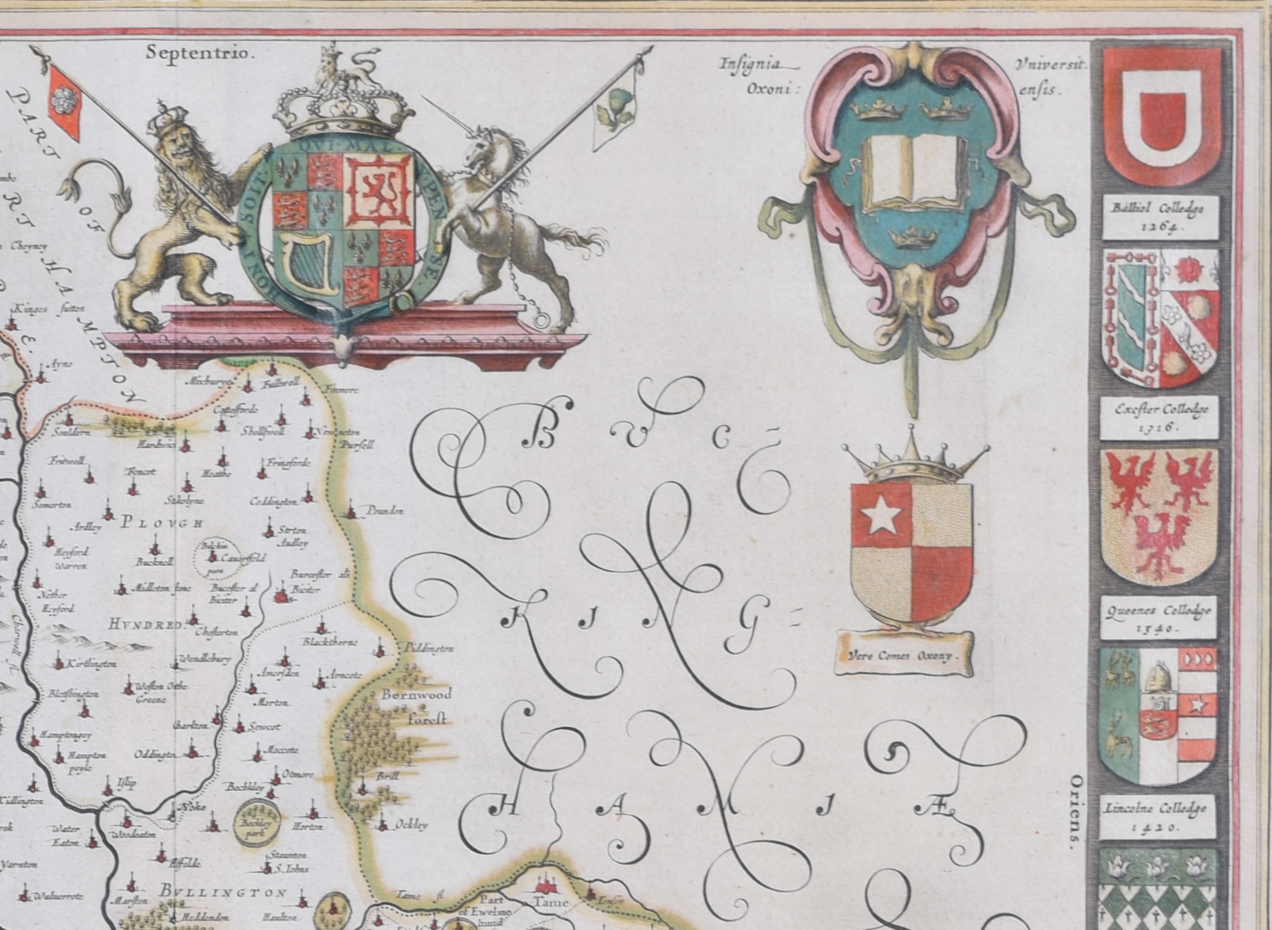
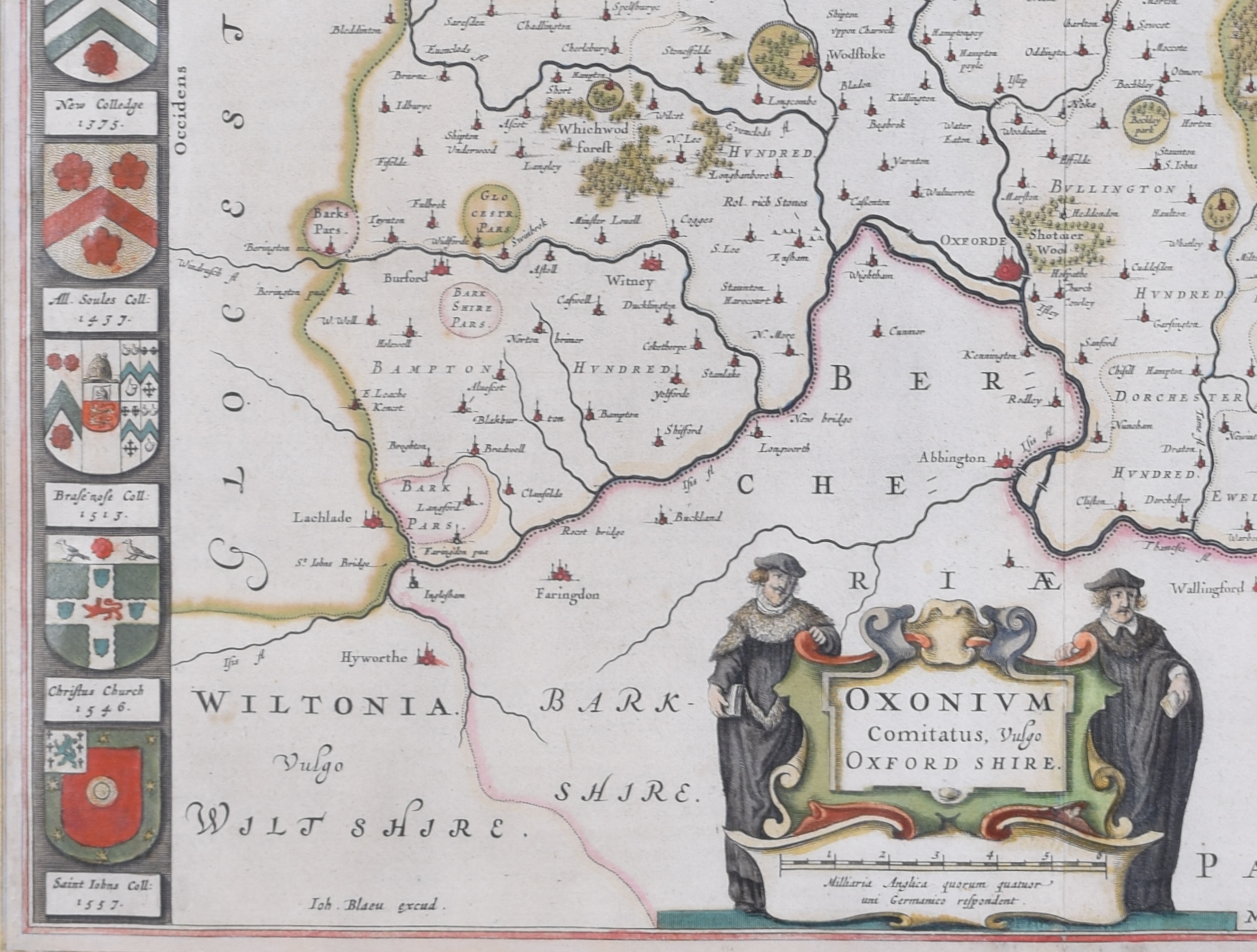
Oxonium Comitatus, Vulgo Oxfordshire (1662)
Engraving with later hand-colouring
38 x 50 cm
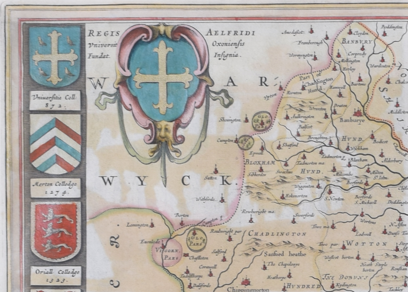
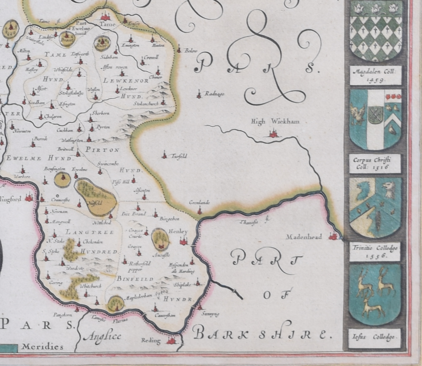
A decorative map of Oxfordshire by the celebrated Dutch mapmaker and artist Joan Blaeu, (son of the cartographer Willem Blaeu). Two Oxford scholars flanks the cartouche which declares the map to be of Oxonium (that is, Oxfordshire), and the design also features the arms of the British Royal Family, King Alfred, and the University of Oxford. Sixteen colleges crests border the map.
Blaeu moved to Amsterdam in 1920 to join the family firm of mapmakers. In 1635, the business published the Theatrum orbis terrarum, sive, Atlas novus in two volumes – the largest and most expensive book published in the seventeenth century, and the venture for which the Blaeu were most famed. Joan and his brother Cornelius took over the studio after their father died in 1638; Joan became the official cartographer for the Dutch East India Company, as his father had been before him.
Condition: mostly very good; area of toning to top left where coloured to reverse. Good oak frame. Framed with reverse visible.
If you are interested, please email info@manningfineart.co.uk or call us on 07929 749056.