
Anonymous
79th Armoured Division, D-Day to the Rhine
Lithograph
c. 1945
20 x 62 cm
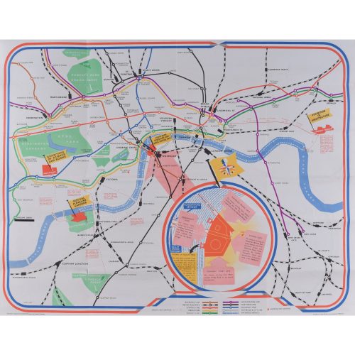
This World War II pictorial map chronicles the 79th Armoured Division, a division of the British Army that was created in the lead-up to the Normandy invasion and commanded by Major General Percy Hobart (1885-1957). The map stretches along the coast of Western Europe, from Brest to Dusseldorf, extending north across the English Channel to show the southern coast of England. Various battles are loactaed with the badge of the division, including D-Day.
The title cartouche includes information about some of the equipment used by the division, such as the so-called Crocodiles (a tank with a flamethrower), Kangaroos (an armoured personnel carrier with a self-propelled gun), and Buffaloes (a tracked amphibious landing vehicle). Beneath the cartouche are illustrations of British soldiers throughout history and a table at the bottom right indicates the strength of the division before crossing the Rhine.
Other examples of this map were originally published in ‘The Story of the 79th Division’, a history of the unit published after the war.