The first atlas to describe itself as ‘historical’ was published over a fifteen-year period beginning in 1705. Published by the Huguenot Zacharias Châtelain in Amsterdam, Atlas Historique included various historical, genealogical and chronological materials, but ended up mostly as a conventional survey of the countries of the world. Johann Georg Hagelgans soon produced a competitor – Atlas Historicus – in Frankfurt, providing four maps showing historical changes between Augustus and Charlemagne – the first eight centuries after the birth of Christ.
In 1750 Johann Matthias Hase’s Atlas Historicus was published. Professor of Lower Mathematics at the University of Wittenberg, he was an academic with interests in many spheres and a skilled cartographer not to mention historian. He produced (though he died in 1743 long before publication) twenty-eight maps with colour-coded time chart showing the empires of the world as they evolved throughout history.
Created around the same time, and held by the Bibliothèque nationale, is an unpublished, undated and unattributed Atlas Complet containing sixty-six identical maps with hand-drawn coloured borders showing the change during history. Although never published, this is the first known collection of maps on this scale.
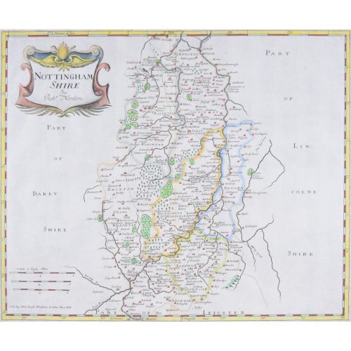
Perhaps on account of its generally stable borders, England did not attract the publication of historical atlases – until Edward Quin. An Oxford graduate and London barrister he died in 1828 at the tender age of 34 and the Historical Atlas was published in 1830. Having taught himself history and geography he proceeded to produce an Atlas that was unprecedented in the English market. Moreover it was a publication of a type that had ceased to be fashionable, but he managed to create an atlas that was more art than atlas.
He wrote in his preface that he wished to offset the fragmentation of history, so that the student would always find “the same territory in the same part of the Map, [seeing] by the changes of colour, the various Empires which succeed each other.” More interestingly he showed only that part of the world “actually known to the geographers and statesmen of that time.” He accordingly uses clouds on the maps to conceal the terra incognita, and the clouds roll away as history unfolds. These clouds are Quin’s very personal device which helps the student to understand the revelation of the known world, but providing also a distinctive decorative form. Thick, black, dramatic clouds obscure the earth and the known world is revealed in glorious technicolour. Fanciful as the early maps may be, locating the Garden of Eden which was explored by Adam and Eve, the discovery of America is a historical reason for a sudden revelation of half of the world. However even once the world has been mapped, the earth is yet to be completely explored, and an olive colour continues to cover much of the earth in the unexplored lands in the last map.
Of course the maps are too small to be much use for proper historical study, but that is to miss the point of the clouds which are made to enact the course of history – rather than the activities of ordinary man. In Goffart’s view it is not that we move to glorious light from primitive darkness, but that the clouds show the extent of our knowledge of the earth; the final clearing of the clouds in 1783 relating to Captain Cook’s Australian voyages, not the American Revolution.
Quin’s original maps were redrawn on a larger scale in 1846 by the cartographer William Hughes for a new edition, omitting Quin’s text. Hughes abandoned the Mercator projection and turned the clouds into mere borders, taking away the dramatic impact. The success – for they were continuously in print for three decades – of Quin’s original maps was not for their geographical or political information, but for their aesthetic impact, the revised edition therefore was not the same success.
This is a masterpiece of nineteenth-century printing, giving rise to glorious inky-black clouds. The dramatic billowing clouds highlight the known world, and neither the fall of Rome nor the Dark Ages causes the discoveries to be hidden again by the return of clouds.
Bibliography: Walter Goffart, Historical Atlases The First Three Hundred Years, 1570-1870 (University of Chicago Press, Chicago and London, 2003) [Goffart’s epic work choses one of Quin’s maps to illustrate the dust jacket, showing the high regard in which he holds Quin’s Atlas.]